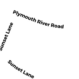
10 PLYMOUTH RIVER RD
Owner Information
LEMONIAS PETER J & DEBORAH C LEMONIAS
10 PLYMOUTH RIVER RD
HINGHAM, MA 02043


Property Details
10 PLYMOUTH RIVER RD is classified as a Single Family Residential (Colonial).
The primary structure on this property was built in 1980. There are 4,670ft2 of built area within this property. There is 2,579ft2 of residential/living space within this property. This property is listed as having 7 rooms.
10 PLYMOUTH RIVER RD is valued at $916,500. The land is valued at $484,100 and the structures are valued at $432,400.
This property is in Zone RB. Confirm with local Zoning Board authorities to ensure there are no overlays or other easements on this property.
The most recent deed for 10 PLYMOUTH RIVER RD is recorded at the local registrar in Book 0350, Page 0135. 10 PLYMOUTH RIVER RD was last sold on Tuesday, October 2, 1984 for $164,000.
Assessment data from fiscal year 2022.
Flood Data
According to the FEMA National Flood Hazard Layer, this property does not appear to be in a flood zone. It may also be in an area not yet reviewed. Nonetheless, confirm this information prior to taking any action.
To view the flood hazards around this property, create a FEMA "Firmette" Map of the area around 10 PLYMOUTH RIVER RD.
Broadband Internet Providers
| Provider | Type | Bandwidth (mbps) | |
|---|---|---|---|
| HughesNet | Satellite | 25 | 3 |
| VSAT Systems, LLC. | Satellite | 2 | 1 |
| GCI Communication Corp. | Satellite | 0 | 0 |
| Viasat Inc | Satellite | 100 | 3 |
| Verizon New England Inc. | Fiber | 940 | 880 |
| Comcast | Cable | 1000 | 35 |
Broadband service provider data from December 2020.
Adjacent Properties
- 12 PLYMOUTH RIVER RD
Single Family Residential owned by RICHARDS JOHN F & - 4 SUNSET LANE
Undevelopable Residential Land owned by OBRIEN FRANCIS T JR & STEPHANIE T TT - 12 SUNSET LANE
Single Family Residential owned by CARPENITO BRIAN J & HEATHER A - 16 SUNSET LANE
Single Family Residential owned by POLLARA CHRISTOPHER ANTHONY & KAITLIN ER - 8 PLYMOUTH RIVER RD
Single Family Residential owned by BEVENS LAWRENCE R & EILEEN W